
Click for PDF
Early Modern Studies Journal
English Department | University of Texas | Arlington
Climate Change and the Great Dying in Sixteenth-Century Peru: Reading the Relaciones geográficas de Indias as Documents of Historical Climatology
Victoria Ríos Castaño, Manchester Metropolitan University
In January 1586, in the district of Yanqui Collagua, close to the city of Arequipa (Peru), the Corregidor (magistrate) Juan de Ulloa Mogollón, with the aid of the Escribano (public notary) Juan Durán, convened an unknown number of meetings with a group of Inca caciques (lords) and encomenderos, Spanish landowners who held grants for the exploitation of lands and peoples.[1] Amongst others, the lords of the town of Hanansaya, Don Juan Halanoca and Don Miguel Nina Taipe, and of Hurinsaya, Don Francisco Chacha, Don García Checa, and Don Francisco Inca Pacta, are named. As for the encomenderos, at least two were present, Francisco Hernández Retamoso and Alonso Rodríguez Picado, together with priests like Father Diego Hernández Talavera, who had served for over twenty-four years in the Inca villages of Guambo and Pinchollo. Their communications were to be bilaterally interpreted in Quechua and Spanish by Diego Coro Inga, a primary school teacher who had been appointed for the occasion: a collation of replies to a questionnaire that would comprise a relación (description or account) of the region and its inhabitants. The final draft would become “La relación de la provincia de los Collaguas” (the account of the province of the Collaguas”), dated 20th January. It would be dispatched to the Spanish initiator of the survey, Juan López de Velasco (ca. 1530–1598), the Principal Royal Chronicler-Cosmographer for the Consejo de Indias (1524) (Council of the Indies), the main administrative and judicial institution of the Spanish Empire.[2]
López de Velasco’s survey request was part and parcel of the Spanish monarchy’s legal-bureaucratic system and their environment of early-modern state knowledge.[3] Cronistas de Castilla (chroniclers or historians of Castille), Cronistas del Reino (of the Kingdom), cartographers, and cosmographers were regularly appointed to create historical accounts, descriptions, and maps so as to facilitate efficient governance and administration of regions.[4] For the gathering of data, they used an información, “a legal investigative procedure and a written document” to establish facts, and a probanza, “a document and method based on an interrogatory” of witnesses answering under oath.[5] López de Velasco’s predecessor, the cartographer and cosmographer Alonso de Santa Cruz (ca. 1505–1567), had similarly understood that successful occupation, expansion, and facilitation of rule and control of newly-acquired territories in Spanish America hinged on familiarity with the land, its resources, and its peoples.[6] To this effect, he undertook the task of sending out a series of “memorias” (questionnaires) to Spanish administrators and local officials in New World colonies, requesting specific information on geography, natural science, demographics, socioeconomics, politics, history, ecclesiastical affairs, and ethnography.[7] Returned replies received the name of Relaciones geográficas de Indias (Geographical Accounts of the Indies).[8]
Santa Cruz had first intended to centralize all the relaciones for the creation of an encompassing chronicle-atlas of the New World. Following suit, López de Velasco plunged himself into its composition and increased the complexity of the process, enhancing the sophistication of the questionnaires and thus of the information returned.[9] A testament to this project is his exhaustive Ordenanzas para la formación del libro de las descripciones de Indias (Ordinances for the elaboration of the book of the descriptions of the Indies), dated in El Escorial on 3rd July 1573. This official document meticulously describes the items for the intended encyclopaedic book and dedicates thirteen ordinances or instructions to describe the brief with which viceroys, governors, Spanish officials, and churchmen had to comply in collaboration with “knowledgeable men,” including Indigenous leaders.[10] After these Ordenanzas, a 50-item questionnaire that was easier to print and lessened the task was designed in 1577 and reedited in 1584.[11] Howard F. Cline identifies a surviving corpus of around 208 Relaciones geográficas, which vary in length and relevance of answers.[12] The 1577 questionnaire seems to have been the most productive, with a return of 166 accounts from the Viceroyalty of New Spain, twelve from Venezuela, seven from the New Kingdom of Granada (northern part of South America), and two from Central America. As for the Viceroyalty of Peru, six Relaciones geográficas were written in the region of Quito as a response to the 1577 questionnaire and around 15 in current Peru, most of which replied to the 1584 reedition.[13]
In line with this special issue on climate change and the Little Ice Age, this study focuses on the Relaciones geográficas of colonial Peru as crucial sources for the history of climate change. The rapid decline of Indigenous populations following colonialization, known as the Great Dying,[14] has been closely connected to both historical cooling and contemporary global warming by historical climatologists, as the first section of this essay discusses. The second section will look at the unexamined accounts from colonial Peru, which furnish narratives about the Indigenous peoples’ conditions and experiences during the first century of Spanish colonization. Importantly, the Relaciones geográficas document in detail population decline across the region, due to disease, enslavement, social disruption, and physical dislocation. Thus, the accounts do not only corroborate the work of climate change that is currently discussed by historians and geographers, but they can also offer further insight into the ways in which colonization impacts both the past and the present.
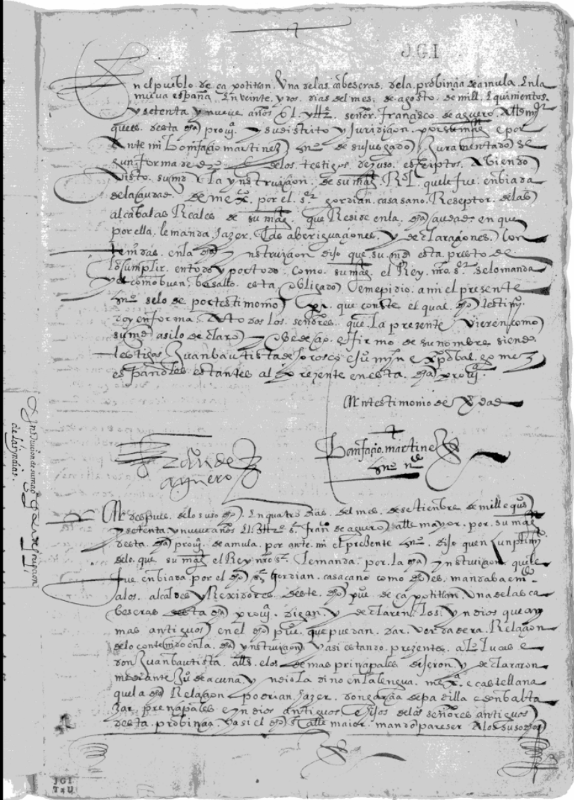
Joaquín García Icazbalceta. Manuscript Collection. Relaciones Geográficas. Opening page from Amula (XXIII-9) aka “Descripción de Zapotitlán, Tuscaquesco y Cusalapa (Provincia de Amula)”.
Reproduced thanks to Benson Latin American Collection, LLILAS Benson Latin American Studies and Collections, The University of Texas at Austin.
Climate Change and the Great Dying
“La relación de la provincia de los Collaguas” (the account of the province of the Collaguas), with which this study opened, showcases the thoroughness of the modus operandi for which the royal cosmographer López de Velasco called. Inca lords, Spanish encomenderos, officials, and priests gathered to cover “todos los capítulos de la […] instrucción” (all the chapters of the […] questionnaire), as highlighted at the beginning and the end of the document.[15] Coro Inga interpreted the questions to the knowledgeable Inca leaders and their replies to the Spaniards. Finally, he passed on all the information to the Corregidor and to the scribe, allegedly “con parecer de todos” (with all in agreement), both Incas and Spaniards.[16] Nevertheless, almost at the very beginning of the account, the fragmentary and devious answer that was recorded for question five, on population numbers before and after the Spanish invasion, tells us the opposite.[17] To begin, the encomenderos’ voice and perception of the Incas as taxable property emerges distinctively. Although the whole province is inhabited by “muchos indios” ( many Indians), only the tally of “indios tributarios casados” (married and tithable Indigenous men), excluding the “chusma” (rabble or populace) of “mozos é niños y viejos é mujeres” (young men, and children, and old men and women), is provided.[18] In Lare Collagua, granted to aforementioned Retamoso and Rodríguez Picado, 2,500 tithable men are counted, and in the province of Cavana, 3,000 men are said “to belong to” (“que son de”) Diego Hernández de la Cuba and Hernando de la Torre.[19] The next item of information appears likewise to be conveyed by the encomenderos: they state that “[f]ueron muchos ménos indios antiguamente” (there were many fewer Indigenous peoples in the olden times) and, since the arrival of the Spaniards, “siempre han ido multiplicando” (they have always been multiplying).[20] Annotated reasons for the Incas’ alleged birthrate boom are “la sanidad de la tierra” (a healthy land) and the lack of “peste ni mortandad notoria” (a noteworthy epidemic or great death).[21] The encomenderos even argue that they have brought a more peaceful life to the Incas, claiming that: “en tiempo de los ingas que señorearon este reino, iban á las guerras […], donde morían” (in the times when the Incas were the lords of this kingdom, [the Inca commoners] went to war […], where they died).[22] Now, as their righteous encomenderos, the Incas working for them “están más descansados é reservados de trabajos después queste reino está pacífico” (are more relaxed and unburdened from work since this kingdom has been brought to peace).[23]
For anyone acquainted with the Great Dying of the Americas, the encomenderos are lying or in denial. Scientific findings demonstrate that the post 1492 invasion and colonization of the Americas triggered the “Columbian Exchange,”[24] a cross-continental circulation of species reconnecting biotas that had been separated for 200 million years.[25] It was not only that crops, such as wheat and sugarcane, were planted in the Americas; corn and potatoes were taken to the Old World. Livestock, such as cows, pigs, goats, and horses, were exported to the Americas, and pathogens, such as swine flu, introduced by these domestic animals, added to those brought by European settlers and the Africans they enslaved: smallpox, influenza, measles, malaria, typhus, diphtheria, diphtheria, yellow fever, and cholera. War, enslavement, forced migrations, and widespread poor living conditions left the Indigenous peoples malnourished and particularly vulnerable to these diseases.[26] By way of example, at the beginning of the sixteenth century, the Inca Empire–the largest in America, encompassing southern Colombia, Ecuador, Peru, Bolivia, Chile, and north-western Argentina–is said to have been home to approximately 20 million, with an estimate of 9 million in the heartlands of Peru and Bolivia.[27] In the late 1520s, waves of smallpox, measles, and influenza epidemics reached different corners of the empire, killing around 30% to 50% of the population. Having been decimated by war, famine, and disease, smallpox ravaged the region in 1558 and struck again alongside measles, from ca. 1585 to 1591, with an ensuing mortality rate of 30% to 60%. It is hard to believe that, faced with this death toll, the Spanish encomenderos who were convened to produce the account of the Collaguas had neither heard of nor witnessed the never-ending decline of their tithable married men. They must have been aware, to say the least, of their dwindling profits. By the 1620s, the heartland of Peru and Bolivia was depopulated by 93%, reduced to about 670,000 Indigenous peoples.[28]
Climatologists and geographers like William F. Ruddiman, Simon L. Lewis, and Mark A. Maslin contend that the Great Dying contributed to Little Ice Age cooling and triggered the beginning of the Anthropocene. Extensive areas of farmland, abandoned after the collapse of Indigenous societies and the decimation of millions of peoples, were reforested: the growing trees sequestered or “sucked enough carbon dioxide out of the atmosphere” to cool the planet.[29] Antarctic ice-cores prove that the global decline in CO2 began in the 1520s and decreased sharply after 1570, reaching a short-lived, but pronounced low point in 1610. Lewis and Maslin name this drop in CO2 the “Orbis Spike,” and suggest that it provoked the coldest glacial advances in the Northern Hemisphere of the Little Ice Age (1300–1850 CE).[30] For them, the 1610 “Orbis Spike” is a geological, human-driven marker reflecting not only changes in global temperatures but also a worldwide interconnection of economies and ecologies and the transition from an agricultural mode of living to a new profit-driven relationship with the environment.
This latest idea is further elaborated in their layman’s adaptation of scientific evidence: The Human Planet: How We Created the Anthropocene (2018). Positing that the human-dominated geological period “began with widespread colonialism and slavery,”[31] Lewis and Maslin act as historical climatologists, expressing an interest in archives of early colonial literature, to reconstruct a historical narrative that buttresses and explains their scientific findings and arguments.[32] Tracking down, amongst others, Columbus’s logbook entries, conquistador Bernal Díaz del Castillo’s historical accounts, Dominican Fray Bartolomé de las Casas’s Memoriales, and the chronicler Fernandez de Oviedo y Valdés’s natural and historical descriptions, Lewis and Maslin offer a vivid picture of casualties of wars, slavery, and the ravaging spread of wave after wave of diseases, both geographically and chronologically, from the Caribbean region in the late fifteenth and early sixteenth centuries, to the fall of the city of Mexico-Tenochtitlan in 1521 and the three major epidemics that decimated colonial Mexico.[33] When it comes to the Inca Empire, they rely on the priest and explorer Fernando de Montesinos’s seventeenth-century chronicle and list the transmission of measles and influenza in the early 1530s and the arrival of smallpox in 1558.[34] Lewis and Maslin are quick to recognize, nevertheless, that these diseases alone did not lead to the catastrophic demise of the Indigenous population in Peru. Wars, the collapse of traditional societies, slavery, and famine must be factored in.
Notwithstanding the relevance of their consulted colonial sources, the sixteenth-century Relaciones geográficas remain unmentioned in Lewis and Maslin’s work. However, they must be brought to the fore to fully understand the Great Dying.[35] In the first place, these are dated and located records, at times offering the approximate numbers of inhabitants, like in the account of the Collaguas. Secondly, the Relaciones geográficas are evocative repositories of how, as Lewis and Maslin put it, the Anthropocene tells us “a story of how people treat the environment and how people treat each other.”[36] Thanks to their official format, the accounts contain answers to the causes and consequences of the Great Dying, as uttered not only by Spaniards but also by the Indigenous peoples, who were officially requested to be actively involved in the production of the accounts. Interestingly, the Spanish recognition of Indigenous knowledge about lands, inhabitants, history, and traditions in the early modern age resonates with the current appeal by historical climatologist Sam White to foreground its pertinence.[37] In his seminal work on early explorations and founding of colonies in North America during the Little Ice Age, White mines colonial sources penned by, amongst others, Gaspar Pérez de Villagrá for New Mexico, Thomas Hariot for Virginia, and Jacques Cartier for Canada.[38] One of White’s conclusions is that “European explorers and settlers should have made more use of local Indigenous knowledge about environment and climates in North America.”[39] For him, this wealth of data could have been instrumental in identifying signs of extreme weather and climate change, including modifications in the fashioning of clothes and footwear, or the location of new lands for agriculture and hunting.
White’s statement on the pertinence of Indigenous voices and input has already been acknowledged by scholars of Colonial Latin America who have made the Relaciones geográficas an object of their attention. Following Álvarez Peláez’s (1993) overarching work on medicine, illness, flora, and fauna and Mundy’s (1996) groundbreaking analysis of cartography in the Relaciones geográficas from New Spain (colonial Mexico), there exists a myriad of studies examining European and Indigenous peoples’ differing conceptions of geographical space, landscapes, and natural resources.[40] More recent academic discussion on the Relaciones geográficas has centered only on those returned from New Spain in the sixteenth century and, particularly, those pertaining to Mesoamerican perceptions on health, illness, healing, and demographic decline. Thus, Barry L. Isaac has showcased that for native informants in central Mexico the causes of their enormous mortality were not blamed on divine will but upon secular and colonial policies, including forced migration, conditions of enslavement, and imposed monogamy.[41] Interpreting the polyphony of voices from both Indigenous and Spanish respondents, José Pardo-Tomás has drawn similar conclusions. The incorporation of these reasons in the Relaciones geográficas would attest to the existence of wide-ranging discussions on the causes of the catastrophic death toll and the waves of diseases, which the respondents witnessed and from which they might have suffered.[42]
Following these two studies and, in particular, Pardo-Tomás’s approach, which collates Indigenous and Spanish answers, the intention of this article is to move the focus of attention to the sixteenth-century Relaciones geográficas that were returned from Peru, and connect their stories of “colonialism and slavery” with the Great Dying of the Indigenous peoples of America, which Lewis and Maslin believe triggered the coolest period of the Little Ice Age.[43] Thus, the account of the Collaguas with which this study started off, although exemplary in validating the rigorousness of the process, will be proven to be a resounding exception because of the encomenderos’ disingenuous voices. In the bulk of the sixteenth-century Relaciones geográficas of Peru, Incas and Spaniards contradict the account of these encomenderos, who painted an idyllic portrait of the Indigenous workers’ lives under their domain. As in the Relaciones geográficas of New Spain, respondents narrate how the Spaniards mistreated the colonized Indigenous peoples by enslaving them, changing their ways of life, and forcing them to abandon their lands, and how the diseases, including smallpox, measles, and typhus, decimated the population.[44]
The Great Dying in Peru
In striking contrast with the account of the Collaguas, for the writing of the Relación geográfica of the province of Xauxa, the Spanish authorities strongly relied on Indigenous respondents. On 16 May 1582, the Corregidor Andrés de Vega, in the presence of the Escribano Juan de Hinestrosa, convened a large group of caciques principales or Inca leaders, including Don Francisco Apocusichac and Don Carlos Lima Illa, who had been provided in advance with the questionnaire, interpreted by one of their peers, Don Felipe Guacra Páucar, so that they could “tra[er] a la memoria todas las cosas más antiguas que tocan […] la instru[cción]” (bring to memory the most ancient things relating to the questionnaire).[45] De la Vega had gone to great lengths in collaborating with the most knowledgeable Incas of the area, including “otros muchos principales é indios de la dicha provincia,” (many other principal Indian men of said province), each of whom had in turn discussed the answers with “ocho indios de los demás […] viejos y antiguos que pudieron hallar” (eight Indians, who were the oldest and most experienced that they could find).[46] Thus, when it came to answering question five of the questionnaire, asking whether the population had increased or decreased after the Spanish invasion, they agreed that the valley was well populated, “aunque dijeron que en tiempos pasados del Inca eran muchos más” (although they said that in times of their Inca [Emperor] they were many more).[47] Contrary to the encomenderos of Collaguas, who counted the Inca population on the basis of whether they were tithable or not, this time the curacas, Inca leaders or chieftains, based their numbers on “indios de guerra” (Indian warriors).[48] Prior to the Spanish invasion, in the territory of Hatun Xauxa there were 6,000; in Hurin Guanca, 12,000; in Hanan Guancas, 9,000. At the time when they were answering the questionnaire, numbers had significantly reduced to 1,200 in Hatun Xauxa; 3,500 in Hurin Guanca; and 2,500 in Hanan Guancas. For the sake of explaining this broader inclusiveness to the Spanish authorities, the Inca respondents state that they are “todos tributarios” (all of them are tithable).[49]
Resonating with the account of Collaguas, the Inca leaders admit that a reason for the decrease rests on “las guerras que tuvieron entre los Incas” (the wars between the Incas).[50] However, they also add that, “se disminuyeron muchos más” (there was a higher decrease) due to “las alteraciones pasadas que hubo entre españoles” (the changes provoked by the Spaniards in the past),[51] namely: the banning of traditional polygamy, sustained by the practice of granting “indios valientes” (brave Incas) two to six and sometimes even more women; the Spaniards’ system of slavery for farming and mining, known as the Andean mita; and other forms of labour exploitation. Regarding the latter, the Incas highlight that “llevaron muchos indios é indias los españoles para yanaconas é servicio, y se quedaban y morían fuera de este valle” (the Spaniards took away many Indigenous men and women as bondsmen and for household service, and they remained and died away from this valley).[52] Those who survived also had to face many illnesses. In their answer to question seventeen, on whether the town’s location is healthy or unhealthy, the Incas explain that the most common ailments, “fríos y calenturas” (colds and fever), occurred due to a change of temperatures (“mudar de temple”) or when travelling to hot lands (“por ir a tierras calientes”).[53] As for mortal illnesses, due to which the respondents acknowledge “suelen morir muchos indios” (many Indians usually die), the following are listed: “alguna manera de pestilencia de toce [tos] y romadizo y cámaras de sangre y dolor de costado y virguelas [sic]” (a pestilence of cough from time to time, and head cold, and dysentery, and flank pain, and smallpox).[54]
The account of Xauxa stands out, not only because of the emphasis on Indigenous knowledge, but also for encapsulating the causes that Inca leaders believed were killing them. In fact, replies alluding to wars, slavery, forced migration, illnesses, and the eradication of polygamy can likewise be traced in the other Relaciones geográficas collected in Peru. In regard to wars and illnesses likely brought by the Spaniards, the respondents of the “Descripción de la tierra del repartimiento de Atunsora” (Description of the granted land of Atunsora) (2nd March, 1586) state that in the times of their ruler, Tupac Inca Yupanqui (d. 1493), the population had trebled, and that their current significant decline dated back to “la conquista […] [cuando] la gente se disminuyó mucho en la guerra y servicio della” (the conquest, when the number of people decreased due to the war and in its service).[55] The account incorporates the official census produced during the 1570–1575 visita general (inspection tour) of the fifth Viceroy of Peru, Don Francisco de Toledo, to reorganize the Andean region into Spanish reducciones or resettlements: 2,459 tithable men in a total population of 15,159.[56] The death of warriors and the Spaniards’ banning of both polygamy and another common practice –young parenting– was also to blame. In the past, “en siendo […] de doce años arriba, el inga les mandaba tener mujeres y […] [era] ocasión de mayor propagación” (from the age of twelve, the Inca lord ruled that [boys and men] should have women and this was an occasion of more propagation).[57]
The respondents of the “Descripción de la tierra del repartimiento de San Francisco de Atunrucana y Laramati” (12th February, 1586) (Description of the granted land of San Francisco of Atunrucana and Laramati) gave a similar answer. Having facilitated the official population count that was recorded upon the viceroy’s request –2,811 tithable men in a total population of 15,262– the Indigenous respondents – curacas and principal men like Don Juan Guancarilla, Don Cristóbal Auchuqui and Don Francisco Curiaymara– concurred that “en el tiempo de Topa Inga hubo más indios que ahora” (in the times of Topa Inga [Tupac Inca Yupanqui] there were more Indians than now).[58] They likewise emphasized the correlation between a larger population and polygamy, comparing the ruling of Tupac Inca Yupanqui with that of his son, Guayna Capac (d. 1527), and concluding that, in times of the former, there were more people “porque el Topa Inga daba a los caciques y principales muchas mujeres” (because the Topa Inga would give caciques and principal men many women).[59] The regulation of polygamy practices appears to have been Guayna Capac’s prerogative; nevertheless, the respondents in San Francisco of Atunrucana and Laramati were adamant that it was the Spaniards’ imposed ways of living, banning the practice altogether, that had resulted in lower natality rates.
Another reason for this decrease rested on forced relocations. Following Toledo’s visita general, “los indios se redujeron a pueblos en las partes que pareció más cómodas a los visitadores” (the Indians were relocated to towns in places that the officials on tour found more comfortable).[60] This decision was fateful for the Incas; they were forced to migrate from their lands and relocate at the decision of new authorities, who chose inadequate sites and did not take into consideration how new settlements would affect the Indigenous peoples’ lives. The respondents further explain that “algunos pueblos que los visitadores poblaron, se han despoblado y pasado a otros sitios que han parecido más cómodos, por orden de los gobernadores desta tierra que después de la visita de don Francisco de Toledo han gobernado” (some towns that the officials on [Toledo’s] tour populated, have been depopulated and moved to other places that seem to be more comfortable, at the order of the governors of this land, who have ruled after Don Francisco de Toledo’s visita).[61] In their answers, the Inca leaders agree that the locations where Indigenous commoners eventually settled had become permanent, “por haber en ellos lo necesario para [su] sustento” (for [the locations] have what is necessary for [their] livelihood).[62] However, they still take the opportunity to raise their subjects’ concerns. The Inca commoners lament that moving “una y dos y tres leguas de donde ellos tenían sus chácaras” (one or two or three leagues, from where they had their fields)[63] made it difficult for them to return to the land of their ancestors, in which “tenían más abundantes sus comidas” (food was more abundant) and they could no longer follow their “orden de vivir” (ways of living).[64]
Information on the deleterious impact of the forced migrations to reducciones (resettlements), along with enslavement, is similarly voiced by Spanish authorities, such as in the “Relación de la ciudad de Guamanga y sus términos” (22nd February, 1586) (Account of the City of Guamanga and its territories), carried out by the Regidor (council official) Pedro de Rivera and the citizen Antonio de Chaves y de Guevara. Both begin their entry to question five by repeating the official count produced during Toledo’s visit. Although they are uncertain whether the county comprised 35,000 or 36,000 inhabitants, they are sure that this figure represents half of the population of the area before the Incas waged wars against the Spaniards.[65] Since then, the “indios […] siempre han ido a menos” (Indian populations have always been decreasing), mostly due to enslavement.[66] They admit, in this respect, that the Incas are obliged to “ir lejos [a] tierra de diferentes temples a las minas de azogue de Guancavelica, de lo cual les sigue notable daño” (go far away to lands with different temperatures, to the mines of metallic mercury in Huancavelica, which causes them great harm).[67] Similarly, when it comes to their forced migration to reducciones, Rivera and Chaves y de Guevara also appear to echo complaints from the Incas. As colonizers, they are under the impression that, since the Incas used to live in less structured settlements, in these new “pueblos formados por la reducción” (towns created in the resettlements), they could benefit from “la pulicía de calles y plazas” (the organization of the space into streets and squares). Nonetheless, the two Spaniards also concur that the Incas’ former life used to be healthier.[68] Ramping up criticism, both men denounce the Spanish authorities as, at times, having taken a wrong decision. Failing to recognize the inadequacies of a location for resettlement, for instance, meant that the Incas could not remain permanently but had to migrate continuously to lands of “diferentes temples y sitios mal sanos” (different temperatures and unhealthy places), “lejos de sus sementeras” (far away from their cultivated lands).[69]
These protests, levelled by the Indigenous respondents of San Francisco of Atunrucana and Laramati and the two Spanish officials in the City of Guamanga, reappear in the “Descripción […] de la provincia de Vilcas Guaman” (Description […] of the province of Vilcas Guaman) (5th March, 1586), as obtained by the priest Baltasar de Soria.[70] The Corregidor Don Pedro de Carabajal delegated upon Soria the task of conducting the survey, for being “hombre de ciencia y [experiencia] y ha mucho tiempo que reside en este reino y sabe bastantemente la lengua general de los naturales” (a man of science and experience, who has lived in this kingdom for long and can speak very well the general language of the Indigenous peoples).[71] Soria behaves as a messenger, reproducing what he has witnessed and heard from his neophytes. Thus, he recounts that the traditional Inca city, Vilcas, had been well populated in the past, serving as a frontier location that was defended by around 30,000 men. However, after the Spanish occupation, these warriors were redistributed and, at the time of writing, the Incas were perishing in considerable numbers for a combination of reasons: “el excesivo trabajo que tienen en acudir a las minas de azogue y plata y ingenios de azúcar” (the excessive work that they are given in the mines of metallic mercury and silver, and on sugar plantations); “el servicio personal que van á hacer á la ciudad de Guamanga y á las estancias de ganados” (the domestic service that they do in the city of Guamanga and on the cattle farms); and the “mudanzas de temples a partes donde van a hacer los dichos servicios” (changes in temperature in places where they go to perform said services).[72] Soria notes in passing that these forced migrations have been the cause of “muchas enfermedades, de las cuales la mayor parte dellos han muerto” (many illnesses, from which the majority of them have died).[73]
Specific details about widespread diseases surface, as well, in the accounts that Soria takes charge of composing in one-day journeys to several towns of Vilcas Guaman: the “Relación de Totos” (6th March, 1586), the “Relación de Chuschi” (7th March, 1586), the “Relación de Zanco y Sacsamarca” (8th March, 1586), and the “Relación de Putica” (9th March, 1586). In his meetings with the “principales e indios más ancianos” (principal and eldest Indians) of several towns,[74] he learns that, although the whole province is said to be “de temple y aire sano” (of healthy temperature and air),[75] the Indians continuously suffer from “calenturas, apostemas y sarna” (fever, abscesses, and scabies) in all areas,[76] “cámaras de sangre” (dysentery) in Chuschi, Putica, and Zanco and Sacsamarca,[77] and “lamparones” (king’s evil or scrofula) in the latter.[78]
The same illnesses are listed in the “Relación fecha por el Corregidor de los Chunbibilcas” (“Account made by the Corregidor of the [region of] Chumbivilcas”), Don Francisco de Acuña, including descriptions of Trujillo de Cotaguaci, Hontiveros de Alca, Llusco and Quinota, Capamarca, Colquemarca, Bellille and Chamaca, and Libitaca and Totora. For the first description, made in the town of Trujillo de Cotaguaci (30th January 1586), Acuña and his Escribano Alonso Díaz de Pareja joined a group of Spaniards, including the Dominican Fray Juan del Orden and the Alcalde mayor (local magistrate) Don Lorenzo Ano [sic], together with a group of Indigenous leaders, such as the main cacique of the town of Achanbi, Don Baltasar Maquerva, and of Cotaguaci, Don García Vilcamaco.[79] Contrary to other locations, the respondents identified that theirs was an “asiento […] enfermo” (ill settlement),[80] where the Indigenous peoples suffered from “calenturas y lamparones y cámaras de sangre” (fevers, king’s evil and dysentery).[81] When Acuña and Díaz de Pareja arrived in the town of Hontiveros de Alca on 3rd February, they seem to have taken with them the collection of answers gathered in Trujillo de Cotaguaci, so as to streamline the process and, possibly, compare answers. They met another group of Spaniards and Indigenous leaders, including the priest Andrés Flores and the main caciques of Alca, Don Francisco Guaxjo Guamani and Don Sebastián Susca Mania. This time the respondents claim that, unlike Cotaguaci, Alca is “asiento [de] buen temple” (the settlement of good climate), and yet, this favourable location did not prevent its inhabitants from contracting some of the same illnesses: “calenturas y cámaras” (fever and dysentery).[82]
A fortnight afterwards, on 17th February, Acuña and Díaz de Pareja, in the company of two Spanish priests, Juan Cabrera and Antonio Osorio, and Inca leaders, such as Don Baltasar Cóndor Cayllagua and Don Francisco Supa, of the towns of Llusco and Quinota, went through the same questions and collated answers.[83] Asked whether the people suffered from the illnesses of Cotaguaci and Alca, the leaders confirmed that “son enfermos de calenturas y cámaras de sangre” (they fall sick with fever and dysentery),[84] but they also incorporated a new ailment, “son enfermos de hinchar” (they fall sick, swelling).[85] There is another unnamed illness that is recorded in the account of the towns of Billille and Chamaca (on 2nd March 1586), supervised by Acuña and Díaz de Pareja, and involving Francisco Sánchez Goliardo and Lope Sánchez de la Cueva, priests of the towns, and Indigenous leaders like Don Carlos Quispi, Don Diego Nina Chaguayo and Santiago Supanta.[86] The respondents repeated or confirmed that the Indigenous population contracted “calenturas y cámaras” (fevers and dysentery) and alluded to “otras que les dan que los vuelve a los indios tontos” (other [diseases] that they contract and which leave them silly).[87] Said illnesses are named in the town of Capamarca, where at least one of the two men who were interviewed by Acuña and Díaz de Pareja, on 23rd February 1586 –the cacique Don Francisco Chatnama and a Spaniard living in said town, Miguel de Anues[88]– were able to identify, probably upon description of symptoms, that the Indigenous peoples suffered from “calenturas y tercianas y cuartanas” (fevers, tertian fever [malaria] and quartan fever [malaria]).[89] The same illnesses are repeated in the account of Libitaca and Totora, commenced on 8th March, in the presence of Acuña, Díaz de Pareja, a Mercedarian friar, Álvaro de Prado, and several Indigenous lords, such as Don Francisco Vilcacuri.[90] They named or validated that the most common diseases were “calenturas y cámaras y cuartanas” (fevers, dysentery and quartan fever [malaria]).[91]
Further north of the Chumbivilcas region, the spread of diseases attributed to forced resettlements are also mentioned in passing in the extensive “Descripción de la tierra del corregimiento de Abancay” (Description of the land of the local jurisdiction of Abancay), supervised by the Corregidor Niculoso de Fornee in eleven towns, from 21st January to 14th March, 1586[92]. Spaniards like Alonso Váez, Juan Velázquez and Juan Gómez, who, as in a judicial process, were requested to answer the questionnaire under oath, made interesting observations about four towns: San Sebastián Pampaconga, San Juan de Patallata, Santa Ana Chonta and Santiago Mollepata. Having answered that these locations were only populated by 2,000 people, they recognize that “en otros tiempos han tenido más y han venido a menos por enfermedades” (in the past they had more and now they are decreased due to illnesses).[93] Pampaconga and Patallata are considered, in particular, as “pueblos […] enfermos” (unhealthy towns) to which the Indigenous peoples had been moved, and in which “les dan enfermedades de calenturas, tabardete y cámaras de sangre” (they contract diseases like fever, typhus, and dysentery).[94] The widespread typhus (tabardete or tabardillo) continues to be reported in other towns in the same jurisdiction and in connection with the poor quality of the settlement. Thus, in the town of Chinchaipuquio, on 8th February 1586, the priest Francisco de Murcia together with the cacique Don Gerónimo Quepqui and a Spaniard, Martín de Salazar, declare under oath that the whole area had been more populated in the past, as they lived “más sanos por causa que cada uno vivía donde quería” (with more health because everyone lived where they wanted to).[95] In their new settlements, described as “reducciones enfermas y no sanas por ser muy húmedas” (ill and unhealthy due to high humidity), the population declined due to the spread of diseases, including “calenturas y tabardete” (fevers and typhus).[96] The two Spanish settlers involved in the accounts of Santiago Hamancay, Santa Catalina de Curauaci and San Pedro de Sayuita, Juan Gómez and Juan Fernández de Escobar, also acknowledge that the Incas used to lead healthier lives. Now, they constantly risk death because “están en caminos reales, de los trabajos de los tambos […] y también por las enfermedades” (due to settlement on main roads, to construction work […] and also to diseases).[97] Interestingly, in what appears to be the concatenation of their replies, both respondents appear to interconnect the reasons. The Incas are dying in numbers because their settlements are in transit zones, where they are overworked to build inns and other infrastructure and find themselves exposed to the arrival of diseases, among which “calenturas y tercianas” (fevers and tertian fevers [malaria]) are named.[98] The spread of these and other epidemics was therefore certain to happen. As they answer the questionnaire –in the town of Anta, on 21st January, 1586– two Spanish colonizers, Pedro de Plasencia and Juan de Luque, who had resided in the jurisdiction of Abancay for over twenty years, and the mestizo (mixed-race) Francisco de Gallegos, concur on the following: Anta and three neighbouring towns (Zurite, Guarocondor and Puquibra) are “en asiento sano y no enfermo” (healthy, not unhealthy settlements), however, “de presente hay enfermedad de tabardete, que ha sido general en todo el reino” (at the present time, there is typhus, a sickness that has been general in the kingdom).[99]
The previous passage brings readers’ attention to the immediacy of a disease that had been spreading around Peru and was, at the exact time when the respondents were answering the questionnaire, killing many and leaving survivors with long-term effects. The whole account of the jurisdiction of Abancay corroborates the forced migration of Indigenous peoples to resettlements or reducciones that are described as “unhealthy” or in poorly situated locations, either on main journey routes, therefore exposing people to the circulation of diseases, or on too humid lands, which negatively affected the production of crops and possibly increased the existence of mosquitoes transmitting typhus and malaria. These were to reach locations that were considered “healthy” as well. In this sense, it is to be noted that the rapid spread of diseases in the reducciones, due to their higher population density when compared to that of former small villages or more open spaces, does not seem to be directly acknowledged. Even colonizers like Rivera and Chaves y de Guevara, who criticized the locations of resettlements, believed that the Incas could benefit from the new organization of their space into squares and streets. Apart from diseases, the Relaciones geográficas presented in this study also speak of other enforced ways of living that continued to reduce populations, mostly due to these resettlements but also to the banning of both polygamy and the practice of allowing boys to father children, and the imposition of the Andean mita or slave-labour in mines of metallic mercury, construction, farming, and domestic service.
The Relaciones geográficas add to the archive of located and dated texts, ranging from historical accounts, annals, census and tribute records, and clerical chronicles, which historical climatologists have at their disposal, and from which they can derive new studies and complement existing ones. This article has emphasized how sixteenth-century respondents, whether Incas, mestizos, or Spaniards, explained in their own words the demographic catastrophe behind terms like the Columbian Exchange and the Great Dying. Like the layers of sediments that record geological changes in the Earth’s system and which, according to scientists like Lewis and Maslin, mark the beginning of a new human-dominated geological period, the Relaciones geográficas can unveil the transcribed voices of those who heard of, witnessed, and directly suffered from the causes and consequences of the Great Dying. Whether or not we accept Lewis and Maslin’s argument for the 1610 Orbis Spike, the Relaciones should be seen as crucial to learn about the history of climate change. Their contents might support comparative analysis and further investigation into demographic trends in other geographical areas, and the larger social and climatic shifts identified by climatologists, historians, and anthropologists. While this study has concentrated on the data that the Relaciones geográficas can give us on the staggering population decrease in colonial Peru and, added to the same trend in Spanish America, its potential impact on climate change, the richness of these accounts must be also taken into consideration for other lines of inquiry, such as the Columbian Exchange of agricultural products and livestock, the climate, and the environment.[100] In this sense, the Relaciones geográficas, first envisaged by sixteenth-century cosmographers like López de Velasco, can be mined by and build bridges between scientists and historical climatologists.
[1]Translations are the author’s unless otherwise stated. For the translation and definition of these colonial positions, see M. C. Mirow, “Latin American Legal History: Some Essential Spanish Terms,” Berkeley La Raza Law Journal 12, no. 1 (2001): 43–86.
[2]This study quotes the first two of the four-volume edition by the zoologist Marcos Jiménez de la Espada, Relaciones geográficas de Indias. Perú (Madrid: Tipografía de los Hijos de M. G. Hernández, 1881–1897); the first volume was published in 1881 and the second in 1885. They are available at <https://fuenteshistoricasdelperu.com/2023/10/08/relaciones-geograficas-de-indias-marcos-jimenez-de-la-espada/> (consulted 22.12.23). For reader-friendly purposes, citations hereafter refer to the editor, Jiménez de la Espada, rather than to the multiple named and unnamed authors of each Relación geográfica de Indias. Jiménez de la Espada, Relaciones geográficas, II, 1885, 38.
[3]Felipe E. Ruan, “Cosmographic Description, Law, and Fact Making: Juan López de Velasco’s American and Peninsular Questionnaires,” Colonial Latin American Review 28, no. 4 (2019): 450–47, 450.
[4]Victoria Ríos Castaño, “The Empire in their Hands: Topographic and Geographic Questionnaires under Charles V and Philip II,” in On Wolves and Sheep: Exploring the Expression of Political Thought in Golden Age Spain, edited by Aaron Kahn (Newcastle: Cambridge Scholars Publishing, 2011), 213–229, 213.
[5]Ruan, “Cosmographic Description,” 456.
[6]Francisco de Solano, “Significación y tipología de los cuestionarios de Indias,” in Cuestionarios para la formación de las Relaciones geográficas de Indias, siglos XVI/XIX, edited by Francisco de Solano and Pilar Ponce (Madrid: Consejo Superior de Investigaciones Científicas), xvii–xxviii, xix; Ríos Castaño, 213.
[7]Ríos Castaño, 213. Analogies between the Spanish questionnaires and other surveys in early modern Europe have been established by Simona Boscani Leoni, “Between the Americas and Europe: Mapping Territories through Questionnaires, 16–18th Centuries,” in Connecting Territories: Exploring People and Nature, 1700–1850, edited by Simona Boscani Leoni, Sarah Baumgartner, and Meike Knittel (Leiden: Brill, 2021), 23–53.
[8]Hereafter referred to as Relaciones geográficas, the title chosen by Jiménez de la Espada; see, Raquel Álvarez Peláez, “El cuestionario de 1577. La ‘Instrucción y memoria de las relaciones que se han de hacer para la descripción de las Indias’ de 1577,” in Cuestionarios para la formación de las Relaciones geográficas de Indias, siglos XVI/XIX, edited by Francisco de Solano and Pilar Ponce (Madrid: Consejo Superior de Investigaciones Científicas, 1988), xciii–cvi, c. The questionnaires, dating from the first half of the sixteenth century to the beginning of the nineteenth century, are available in Francisco de Solano and Pilar Ponce’s invaluable 1988 edition. Bibliography on the sixteenth-century reports is extensive. For an introduction, aside from Solano and Ponce’s co-edition, see Howard F. Cline, “The Relaciones Geográficas of the Spanish Indies, 1577–1586,” Hispanic American Historical Review 44, no. 3 (1964), 341–74; Raquel Álvarez Peláez, La conquista de la naturaleza americana (Madrid: Consejo Superior de Investigaciones Científicas, 1993); and Barbara E. Mundy, The Mapping of New Spain: Indigenous Cartography and the Maps of the Relaciones geográficas (Chicago: Chicago University Press, 1996). For a comprehensive exposition on the fate of the Relaciones geográficas, which ended up in private hands, archives, and university libraries, see Cline, 356–361. Most of the accounts returned in the sixteenth and early seventeenth centuries have been published. The most famous and completed edition was undertaken by René Acuña, who gathered those of New Spain (colonial Mexico) in ten volumes; see Relaciones geográficas del siglo XVI (México: Publicaciones de la Universidad Nacional Autónoma de México, 1982–1987). Continuous academic interest in the Relaciones geográficas is reflected in the digital project at the Llilas Benson Latin American Studies and Collections (University of Texas at Austin) and “Digging into Early Colonial Mexico” (Lancaster University, UK). The latter maps the accounts and offers a gazetteer and digital datasets for text mining.
[9]For more information on Santa Cruz and López de Velasco’s endeavors, see María Portuondo, Secret Science: Spanish Cosmography and the New World (Chicago: University of Chicago Press, 2009).
[10]See full transcription in Solano and Ponce’s edition, Cuestionarios para la formación, 16–74. The request for “personas inteligentes de las cosas de la tierra” (knowledgeable people on the matters of the land) remained in other questionnaires; see Sola